Drone Technology
Where Vision Meets Altitude
Purie Ai Smartlabs
System Design | AI Analytics | Integration | After-Sales Support
At Purie AI Smartlabs, we are redefining aerial innovation through AI-enabled Drone Technologies that deliver unmatched intelligence, automation, and precision for mission-critical operations across industries.
Our UAV platforms are engineered for industrial inspections, surveillance, agriculture, logistics, mapping, and emergency response, equipped with autonomous flight control, advanced machine vision, and powerful AI analytics — transforming raw aerial data into real-time, actionable intelligence.
From compact inspection drones for confined spaces to heavy-duty autonomous delivery drones for large-scale logistics, Purie AI is building the next generation of unmanned aerial systems that elevate productivity, safety, and operational efficiency across sectors.
Our Mission
To empower industries with intelligent aerial robotics that seamlessly merge data, automation, and AI — enhancing decision-making, boosting operational efficiency, and supporting environmentally sustainable practices.
Our Capabilities

AI-Driven Flight Intelligence
Cutting-edge airborne intelligence enabling autonomous, reliable, and mission-optimized drone operations.
- Fully autonomous flight capabilities featuring real-time navigation, adaptive path planning, and intelligent obstacle avoidance for safe and efficient aerial missions.
- Advanced AI algorithms for object detection, terrain mapping, and environmental interpretation, delivering precise insights for inspections, surveillance, agriculture, and analytics-driven operations.
- Vision-based navigation and on-board edge AI processing ensure stable and accurate flight even in GPS-denied or signal-challenged environments, enabling resilient performance across complex terrains..

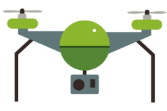
Industrial Inspection & Surveillance Drones
Advanced aerial systems engineered for precision monitoring, asset inspection, and high-accuracy situational awareness.
- High-resolution visual imaging and thermal sensing ideal for inspecting power lines, substations, solar plants, wind turbines, industrial facilities, and high-risk zones.
- Automated, repeatable flight missions with geotagged data capture, ensuring consistent documentation and reduced manual effort.
- AI-powered anomaly detection capable of identifying cracks, hotspots, corrosion, structural deformation, and thermal irregularities in real time.
- Centralized monitoring dashboard providing live video feeds, health analytics, mission logs, and automated inspection reports.
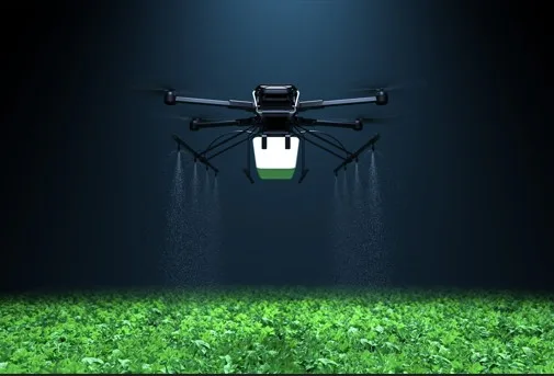
Agriculture & Environmental Drones
- Multi-spectral imaging for crop health assessment, stress detection, and yield forecasting.
- Autonomous spraying drones for precise fertilizer, pesticide, and micro-irrigation application.
- AI-powered NDVI analytics enabling data-driven farm management and optimized cultivation.
- Environmental monitoring drones for air-quality analysis, pollution mapping, and ecological assessment.
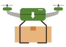
Logistics & Delivery Drones
- Payload-optimized UAVs for industrial part transport, e-commerce deliveries, and urgent medical supply distribution.
- AI-driven route optimization ensuring faster, safer, and energy-efficient delivery missions.
- Smart docking and auto-recharging systems enabling continuous, round-the-clock operation.
Mapping, Surveying & Data Analytics
- LiDAR and RTK-enabled drones for ultra-precise mapping and geospatial measurements.
- 3D terrain modeling, volumetric calculations, and site-progress monitoring for construction, mining, and infrastructure projects.
- AI-driven data analytics converting raw aerial data into actionable insights for faster decision-making.
Applications
Infrastructure & Asset Inspection
Power grids, pipelines, telecom towers
Agriculture & Forestry
Crop spraying, field mapping, environmental monitoring
Défense & Surveillance
Border patrol, reconnaissance, and area monitoring
Mining & Construction
Topographic surveys, stockpile management
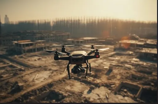
Disaster Response
Search and rescue, aerial situational awareness

Smart Cities & Civic Management
Traffic, waste, and environmental control

Key Features
- AI-powered autonomous flight for intelligent, self-managed aerial missions.
- Real-time telemetry with cloud-based data management for full operational visibility.
- GPS + vision-based hybrid navigation ensuring stable flight in complex or GPS-limited environments.
- Modular payload support including cameras, thermal sensors, LiDAR, sprayers, and custom tools.
- Rugged industrial-grade design built to withstand harsh outdoor and industrial conditions.
- Long-endurance performance supported by intelligent power optimization and smart battery systems.
- Cloud dashboard for mission planning and analytics enabling centralized control and insight-driven operations.
R&D Focus
Our Drone Innovation Lab is dedicated to advancing next-generation unmanned aerial systems through cutting-edge research and engineering.
- AI-driven flight control & autonomous mission management for smarter, safer, and fully automated operations.
- Advanced computer vision and sensor fusion enabling precise perception, mapping, and situational awareness.
- 5G-enabled communication systems for low-latency, high-bandwidth drone connectivity and remote operations.
- Edge AI processing for real-time image analysis, anomaly detection, and on-board decision-making.
- Seamless integration with factory automation & logistics systems for end-to-end industrial workflows.


Benefits
- Safe, contactless inspection of high-risk areas
Eliminates the need for human entry into hazardous or hard-to-reach zones. - Real-time data capture & intelligent analytics
Immediate insights for faster decision-making and improved operational clarity. - Reduced operational time & manpower
Automated missions significantly cut inspection cycles and labor requirements. - High-accuracy, repeatable aerial mapping
Consistent results with precision imaging, LiDAR, and geotagged data. - Cost-effective asset monitoring & maintenance
Early anomaly detection lowers repair costs and minimizes downtime. - Environmentally sustainable operations
Energy-efficient drones reduce carbon footprint and enable eco-friendly monitoring
Technology Partners